
Maps of
Five Miles on the Gauley
a 1336-acre land campaign in Nicholas County, WV
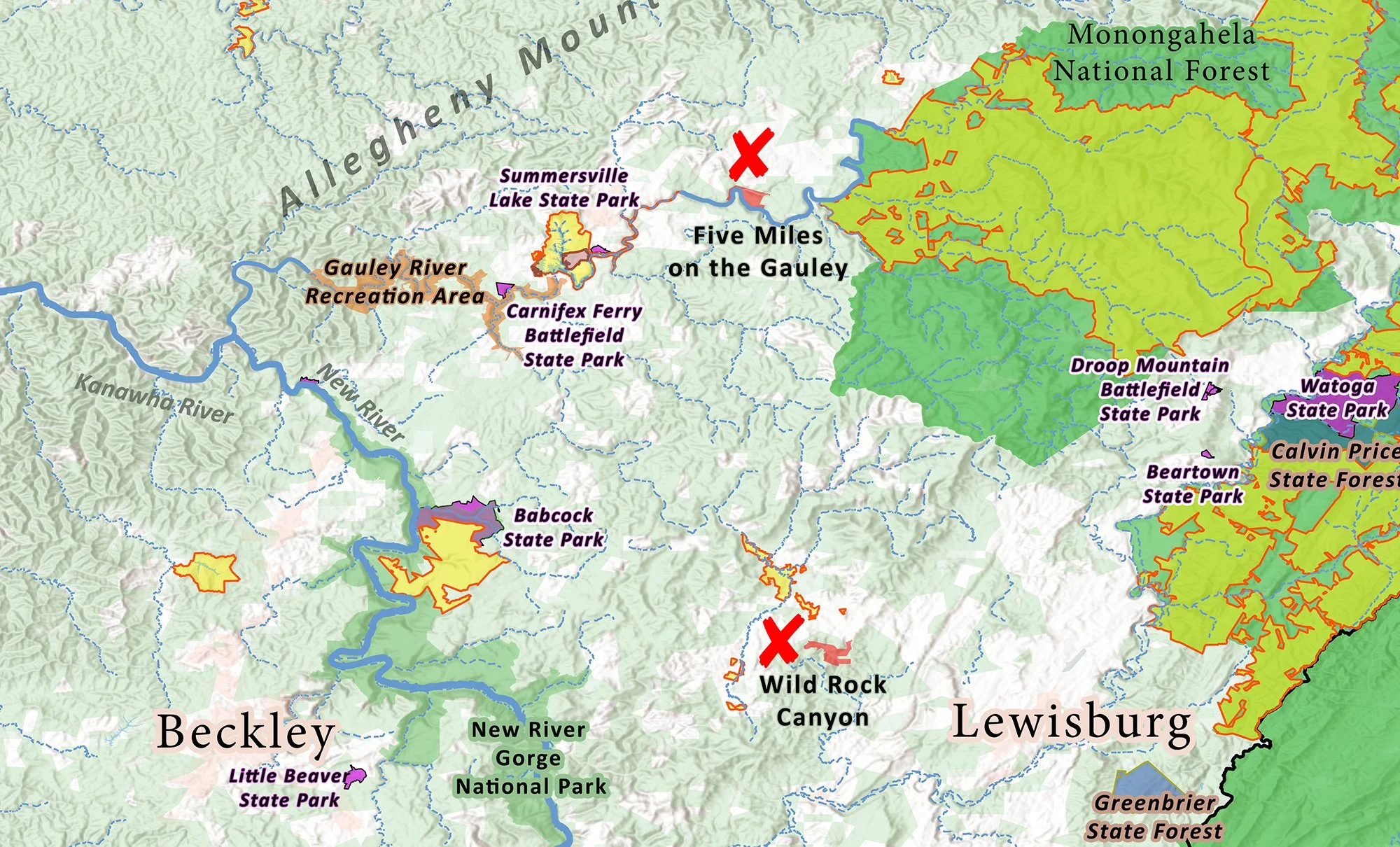
Five Miles on the Gauley is located in southeastern West Virginia - west of the state’s highest Appalachian Mountains and Monongahela National Forest. Thirty miles to the southeast is New River Gorge National Park. Near the center of the map and highlighted in orange, you will see Five Miles on the Gauley as well as Wild Rock Canyon Preserve - a nearly completed Arc of Appalachia campaign that began in late 2024. Note that the region in the center of the map is rich in public recreational lands, but is otherwise largely unprotected.

Enlarging the map, you can see how the Gauley River joins with the New River to form the Kanawha River, which then flows north into the Ohio River. The New River drains much of the heartland of Appalachia as it travels through three states: North Carolina, Virginia, and West Virginia. Much of the Gauley River corridor and nearly the entirety of its upper watershed are protected in national conservation lands. Five Miles on the Gauley will add additional protection of the river for a significant number of river miles, and is located in one of only two stretches of the Gauley that are in private hands.
The map below shows the boundaries and location of Five Miles on the Gauley, The intense bend of the river is referred to locally as the Crupperneck, and it is a notable topographical feature.
