
Fort Hill Earthworks
Trail Description
Address: 13614 Fort Hill Road, Hillsboro, OH 45133
Download and Go! - Hiking Guide and More Information
A dog owner's guide to hiking the Arc of Appalachia

Everything you need to know before you hike:
You are entering a highly protected nature preserve. Regulations exist to protect natural communities from the impact of public visitors. Please follow these regulations to leave Fort Hill as beautiful as you found it. Remain on trails at all times and walk in single file to protect bulbs of native wildflowers bordering the trail. Do not disturb, pick or collect flowers, plants, rocks, or wildlife. Hunting, caving, fishing, trail biking, rock climbing, wading, campfires, and swimming are prohibited. Click here for a list of full regulations.
Dogs are permitted at Fort Hill. A dog owner’s guide to hiking Arc Trails.
Address: 13614 Fort Hill Road, Hillsboro, OH 45133
Directions: Fort Hill Preserve is located in Highland County, one mile west of OH-41 South on Fort Hill Road. Fort Hill is 12 miles south of Bainbridge off OH-41 South; 10 miles south of Rainsboro off OH-753 South; and 11 miles north of Locust Grove off OH-41 North. The preserve is well-signed with ample parking. GPS: N39 6.2' / W83 21.73'
Interpretive kiosk: An interpretive kiosk is located at the trailhead. We encourage you to take a picture of the trail map with your phone before hiking the trails.
Fort Hill hiking trails are open from sunrise to sunset. Please note parking lots are not winter-maintained and the trails are not safe to hike during periods of heavy rain, ice, and snow. Trails are closed during our annual Deer Management Hunt which takes place on the 1) Monday through Sunday following Thanksgiving, and 2) Saturday and Sunday before Christmas.
Shelter house: Picnicking is a very popular and historic activity at Fort Hill, and the park offers some of the most beautiful picnic grounds in the state. The grounds are shaded by tall trees and dissected with a small meandering stream. The handsome picnic shelter was built in the 1930s by the Civilian Conservation Corps from native rock and wormy chestnut. Grills are available at both the picnic shelter and picnic areas. Fort Hill’s picnic shelter is a first come, first served, reservations are not required but can be made for $50/day by calling us at 937-365-1935.
Hiking Trails’ Difficulty - Difficult. Trails are steep and rocky with a number of ascents and descents. This trail could be difficult for people with limited flexibility and strength. Safety Note: Canby’s Mountain Lover Trail has a unimproved creek crossings that can be hazardous. Consider recent rainfall accumulations before planning a trip.
Fort Hill’s Five Hiking Trails:
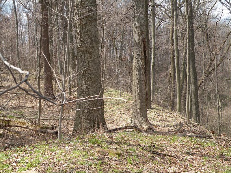
The Fort Trail - 2.2 mile ascends from the base of the hill to the top of the ridge, providing not only a steep climb but also the best views of Fort Hill’s earthworks. The trail enters the enclosure through one of the ancient gateways and follows the wall of the earthworks for a considerable distance.
Deer Trail - 1.2 mile leads through a rolling landscape and a beautiful mature forest. It does not ascend the ridgetop, but in winter it offers a view of the rim of the earthworks from the viewpoint of the valley floor.
The Gorge Trail - 3 mile inarguably the most scenic of all the trails at Fort Hill. The path leads by the cliff-lined and boulder-strewn course of Bakers Fork, three stone arches, and a standing pioneer log cabin. Wildflowers in the spring are outstanding.
Canby’s Mountain Lover Trail - 3 miles The trail leads through gorgeous remote Appalachian hill country with fine forests and excellent views, but it can be dangerous when the water crossings are deep and cold. Summer hiking is safest when wading is an easy option. Please cross waterways with caution.
Connector Trail: Use the connector trail to follow the Fort Trail to the earthworks and return by the Deer Trail, making a shorter loop.
To view the circle mound: Hike to the south end of the park and follow the southern leg of the Buckeye Trail away from the preserve. When it leaves the forest and enters a grass meadow, look for the raised rim of the circle mound to your right. The mound is rarely mowed and might be hard to spot in tall grass. Hikers are permitted to leave the trail to access this site.